Mobile Mapping Apps
Here we take a look at some mobile apps for bike enthusiasts. Catering to travelers and fitness enthusiasts is a fast-growing part of the app business, and cyclists are seeing their fair share of take-with-you tools to track our workouts, map our rides, and find shops and of course refreshments. By the time you read this, in fact, the landscape has likely evolved further. We just can’t keep up!
Two great UK-based bike apps for the iPhone: Bike Hub Cycle Journey Planner and London Cycle: Maps & Routes.

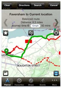
Bike Hub Cycle Journey Planner for the iPhone is a nifty little app that uses the iPhones GPS to track your journey and to suggest routes (including road and off-road routes as well as bike paths). Not only does it suggest routes, the app provides turn-by-turn directions.
The app works by integrating routes posted to Cyclestreets.net (the site crowdsources UK routes and route photos) with routes identified on OpenCycleMap, a slick mapper that goes Google Bike Maps one better by using a more visually-pleasing OpenStreetMap base.
What’s more, the app pinpoints bike shops along the route within six miles of the user’s position – and that’s very handy when you have a chain-break or you’ve forgotten to bring a spare tube! This on-the-fly mapper is produced for the Bicycle Association of Great Britain and is funded by a ‘Bike Hub’ assessment levied on manufacturers in the UK. Thus the app unites three stakeholder communities that share common cause in promoting cycing but too often exist in disparate spheres: cyclists, manufacturers, and retailers. An added bonus: the app includes a calendar of bike-related events. Check it out.

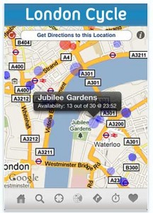
London Cycle: Maps & Routes is a free urban cycle route planner that seems to have cornered the market for London bike apps.
London Cycle maps your route from origin to destination and also shows rental stations across the city (handily including a pricing mechansm and timer to remind the user to return the rental prior to beginning the next time period).
Like the Journey Planner above, it is foremost a map app. It features an offline map, meaning that even when your cell service flags you’re not a guide.

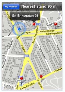
And speaking of bikeshare apps, Citybikes in Stockholm is another in a growing set of apps in Europe (and now the US!) that make bike sharing more convenient. Stockholm has over one hundred Citybikes bicycle stations now (a joint initiative between City of Stockholm and the ad giant Clearchannel, which is moving into the US bike share market too).
This app is the unofficial iPhone app (which is also available for Android) and goes head-to-head with the official app, City Bikes Finder Stockholm. Both help you find stations when you need them. The Citybikes in Stockholm not only locates those closest to your position, but helpfully provides distance-to-bikestation too – showing that in the app universe there is always room to improve on the official offerings.
Pingback: Better Bike
Pingback: More mobile bike apps…. | Better Bike