Sunday Ride Recap!
![]() Our first Better Bike Beverly Hills ride went off without a hitch this past Sunday. It was our first opportunity to get out in the field. After several meetings talking about bike plans, we stopped at some key opportunity sites at the north end of the business district. On hand was Alexis Lantz, policy director for the Los Angeles County Bicycle Coalition (LACBC), who took to her saddle from Silver Lake to put her measuring wheel to Santa Monica boulevard. Alexis also put an official imprimatur on the ride. We’re a group new to the cycling advocacy scene, relatively speaking, and the LACBC has been very helpful in putting us in touch with local riders and even suggested Sunday’s ride. It won’t be the last. Here’s the recap!
Our first Better Bike Beverly Hills ride went off without a hitch this past Sunday. It was our first opportunity to get out in the field. After several meetings talking about bike plans, we stopped at some key opportunity sites at the north end of the business district. On hand was Alexis Lantz, policy director for the Los Angeles County Bicycle Coalition (LACBC), who took to her saddle from Silver Lake to put her measuring wheel to Santa Monica boulevard. Alexis also put an official imprimatur on the ride. We’re a group new to the cycling advocacy scene, relatively speaking, and the LACBC has been very helpful in putting us in touch with local riders and even suggested Sunday’s ride. It won’t be the last. Here’s the recap!
Setting Off From South Beverly Drive
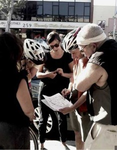 We set off just blocks from the (not-quite-to-the-sea) future subway station and cruised west on Gregory Drive. We then jogged a block north and headed west on Charleville Drive through a wonderful residential multifamily community that I call home. These streets are quiet country lanes topped by a tree canopy that are a cyclist’s dream on a weekend. During the week, however, motorists favor them too as cut-throughs to avoid Wilshire and Olympic.
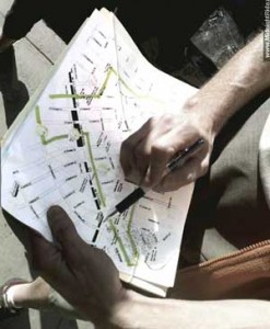 With two travel lanes and parking on both sides, these streets present a challenge to cyclist and motorist alike: without share-the-road signage or pavement markings it’s tough to share. Yet they are part of a promising neighborhood network that would complement a regional ‘backbone’ that includes Santa Monica, Sunset, and Olympic boulevards.
Charleville would clearly integrate well into that network. It connects the Century City bike lanes to the west with the Wilshire/La Cienega/San Vicente hub in the east – a jumping-off point for West Hollywood, Hollywood, and Mid-City.
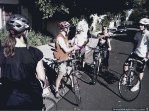 For cross-town riders who feel that Wilshire is a gantlet, Charleville fills that gap. For example, from Hollywood I usually ride 6th Street west to San Vicente, where I drop down to Wilshire west for a few blocks. I then bump down a block to Charleville and west. It’s a great connector for the Westside, especially if you’re coming from up north on Santa Monica or Sunset (see below).
Checking Out the Western Gateway
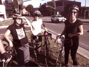 Following Charleville west to the city’s western boundary (left), we paused to see where Santa Monica Blvd. splits into north and south corridors. On the north (main) SM alignment, the city proposes only one eastbound Class II (on-boulevard) bike lane. Westbound it has proposed following Carmelita, which is a cut-through already for westbound cyclists, but (like Charleville) studded with stops.
Standing at the fork, we talked about the constraints as expressed by the city: that the roadway is too narrow, and that taking a few feet (which the city already owns) from Beverly Gardens Park is a non-starter for policymakers. “Relax – we won’t be widening the boulevard,” our Mayor said recently in Council Chambers when opening discussion of the Santa Monica boulevard improvements to be completed by 2012.
We looked to the South SM Blvd. corridor as an eastbound alternative (or complement) to a lane on the big boulevard. The positive: a bike route along South SM would bring cyclists into the business district along the northern edge, past small retailers. It would integrate cyclists into a local bike streets network to complement regional thoroughfares. The negative? For efficiency-minded cyclists there is no substitute to two on-boulevard lanes. But these options are not mutually exclusive: our city needs both the regional network with lanes and bike-friendly local streets with share-the-road markings, signage, and hopefully lanes.
Golden Triangle: Invite the Bikes In!
Our group on Sunday considered the possibilities of a business district bike route from the vantage point of South SM Boulevard and Beverly Drive. This is the apex of the Golden Triangle, next to the historic former Post Office (below), soon to be part of the coming Annenberg Center (which is under construction). South SM Blvd. Nearby are several big employers, not to mention a stable base of smaller retailers.
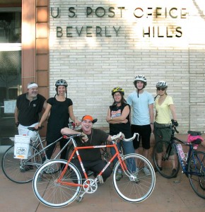 City policymakers recognize that the vitality of the city is directly related to commerce, and they are aggressive about promoting business here. But it’s not all about the glossy retailers and Rodeo Drive. Beverly Hills is underrated for its small business base – the everyday retailers that make living here convenient and that are a potential draw from a larger area. Why not bring these potential customers in on cycles instead of cars?
There is reason to think outside the box to attract non-motorist shoppers. Our city has spent lavishly to construct hundreds of additional car spaces while providing virtually no accommodations for cyclists. And now we are about to slip into a serious revenue red zone. In front of council this week were strategies to make up for a multimillion dollar hole that will emerge if voters approve universal two-hours-free parking in March. On the table are taxes and fees to extract from businesses the benefit they receive from taxpayer-subsidized parking.
One look at the north end of the business district suggests that the future can be bike-friendly if policymakers recognize the value of cyclists to the local economy. South SM Blvd. is a key east-west corridor and potential opportunity for an eastbound bike lane. It would not only junction Beverly Drive, a major north-south small-business corridor, but South SM Blvd. would also bring cyclists right past two of the city’s cultural jewels: the Annenberg Center and the Museum of TV and Radio.
North of the Boulevard are Bike-Friendly Streets!
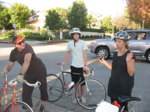 Taking in the potential, our group turned north on Beverly past the Beverly Gardens Park and then turned east on Carmelita (at right), which would indeed make a wonderful neighborhood network street. We turned south on Rexford, past City Hall and the Civic Center and its lonely, only, wheel-bending bike rack. We continued on to Burton Way.
Burton Way: Our Bike Boulevard?
Burton Way is a continuation of South SM Blvd after it emerges from the Golden Triangle. East of Crescent, Burton changes character completely from small shops to wide boulevard with grassy median. This stretch and the median too are a legacy of the Pacific Electric ‘red car’ line that once stopped near the old Post Office on its way to Sawtelle. Rethinking Burton as a multi-modal transit corridor that would include bicycles is a great step back to a time when we could traverse the region without a car. Today Burton is a residential corridor that connects the business district to the commercial spine of Robertson Boulevard to the east, making the relatively higher density here a good opportunity for bike lanes (see the potential boulevard and suggested neighborhood bike streets illustrated on the map).
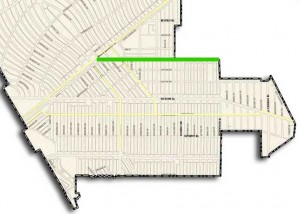 To the east, Burton junctions with Robertson Blvd. Cyclists know Robertson as a perilous ride. It’s a door-zone horror because of valets and boutique/restaurant traffic. South of Wilshire brings some respite, but then approaching Pico and beyond it becomes hostile territory for cyclists.
Beverly Hills shares Robertson as part of an irregular eastern boundary with City of LA. This corridor is on LA’s bike projects list, but it’s not on our radar yet. And it must be because neighboring cities must coordinate bike improvements. It only makes sense that our city’s network of bike streets would integrate with what’s planned for Robertson.
Burton Way is perfect for a future bike boulevard to connect our business district with the commercial corridor of Robertson. So perfect, in fact, that our city has already identified it for off-street bike lanes – but in the median, not on the boulevard. Presenting Burton bike facilities as a recreational amenity rather than as transportation improvement would be a missed opportunity. This wide boulevard and grassy median are tailor-made for a signature Beverly Hills bike boulevard. With on-boulevard lanes.
Let’s Get With the Program!
Standing on Burton Way we talked about Better Bike Beverly Hills partnering with the Farmers Market to encourage cycling to the market on Sunday (discussions are underway). Promo programming is the low-hanging fruit that’s ripe for the picking. Let’s make the Civic Center’s library and Farmers Market the focus of bike outreach and education. Complement it with safety improvements to allow students and shoppers to bike there. This is relatively low-cost and not difficult to implement. Besides, it’s often supported by state and federal grants. But our city has not reached for them.
It’s About Connecting the Schools
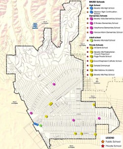 Beverly Hills has a tightly-grouped network of schools (see the map). Our tour passed one opportunity site where bike programming could be rolled out: the Beverly Vista School (at Charleville and Crescent). Safe Routes to School is a federal initiative to encourage walking and biking to school (just like when I was a kid). And the government has put real money on the table for road improvements, signage, and outreach and education programs. A recent call to the BH Unified school district suggests that it’s not been on the radar of school officials.
Beverly Vista, like many of our schools in Beverly Hills, is a neighborhood school that draws from a small community. It even looks like a neighborhood school! But aside from crossing guards, there is nothing on blocks surrounding the school or on blocks adjacent to suggest that we want to encourage kids to walk or ride. That too has to change!
We wrapped up the ride at Peets where we talked about the current state of affairs. As at every meeting, ideas flow. Now it’s time we take up the challenge and start putting these ideas into practice. If you were not able to make the ride, we still welcome your ideas!